The Snowdonia Way
A walking route through Snowdonia from Machynlleth to Conwy
Nonfiction, Travel, Europe, Great Britain, Sports, Outdoors, Hiking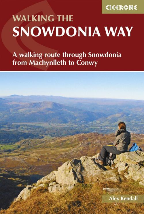
| Author: | Alex Kendall | ISBN: | 9781783624553 |
| Publisher: | Cicerone Press | Publication: | March 30, 2017 |
| Imprint: | Cicerone Press | Language: | English |
| Author: | Alex Kendall |
| ISBN: | 9781783624553 |
| Publisher: | Cicerone Press |
| Publication: | March 30, 2017 |
| Imprint: | Cicerone Press |
| Language: | English |
This guidebook describes the Snowdonia Way in Wales, a long-distance route through Snowdonia National Park from Machynlleth to Conwy. A low-level route of 97 miles (in 6 stages of between 13 and 21 miles) passes through the heart of Snowdonia's stunning mountain scenery and includes Pass of Aberglaslyn, Ogwen Valley and Aber Falls. It is suitable for walkers of average fitness and stamina, though the day stages are long. An alternative mountain route covers 122 miles in 9 stages of 12-18 miles giving a spectacular journey over the most famous peaks such as Cadair Idris, Snowdon and Glyders. The high-level route is more physically challenging and requires good navigation skills. Full route descriptions for each stage are accompanied by OS maps and profiles. The guide also includes lists of accommodation and transport providers and a table of facilities to help with itinerary planning. Background notes on Snowdonia's geology, wildlife and history and extra information about features encountered along the way will help you discover more about this ancient and beautiful land.
This guidebook describes the Snowdonia Way in Wales, a long-distance route through Snowdonia National Park from Machynlleth to Conwy. A low-level route of 97 miles (in 6 stages of between 13 and 21 miles) passes through the heart of Snowdonia's stunning mountain scenery and includes Pass of Aberglaslyn, Ogwen Valley and Aber Falls. It is suitable for walkers of average fitness and stamina, though the day stages are long. An alternative mountain route covers 122 miles in 9 stages of 12-18 miles giving a spectacular journey over the most famous peaks such as Cadair Idris, Snowdon and Glyders. The high-level route is more physically challenging and requires good navigation skills. Full route descriptions for each stage are accompanied by OS maps and profiles. The guide also includes lists of accommodation and transport providers and a table of facilities to help with itinerary planning. Background notes on Snowdonia's geology, wildlife and history and extra information about features encountered along the way will help you discover more about this ancient and beautiful land.