The Pennine Way
From Edale to Kirk Yetholm
Nonfiction, Travel, Europe, Great Britain, Sports, Outdoors, Hiking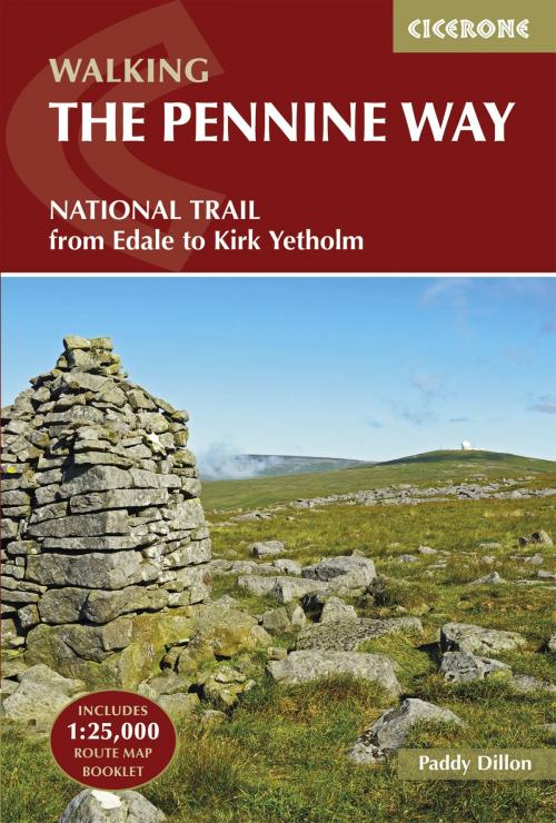
| Author: | Paddy Dillon | ISBN: | 9781783624768 |
| Publisher: | Cicerone Press | Publication: | March 31, 2017 |
| Imprint: | Cicerone Press | Language: | English |
| Author: | Paddy Dillon |
| ISBN: | 9781783624768 |
| Publisher: | Cicerone Press |
| Publication: | March 31, 2017 |
| Imprint: | Cicerone Press |
| Language: | English |
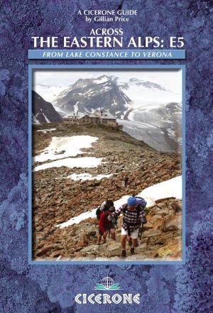
The Pennine Way is Britain's oldest, toughest long-distance footpath - and arguably its most iconic. Now a National Trail, the 427km (265½ mile) route from Edale in Derbyshire to Kirk Yetholm in the Scottish Borders offers wayfarers the opportunity to immerse themselves in wild beauty of the North. The Pennines boast rolling hills, sweeping moorland and wide glacial valleys, and the Pennine Way has come to embody personal challenge and adventure. This guidebook presents the route in 20 daily stages of 10.5-31.5km (6½-19½ miles). Step-by-step route description is accompanied by 1:100,000 mapping and information about points of interest along the way, as well as advice on facilities and planning your trip, tips for walking the route and an alternative 15-day itinerary. Useful contacts and full accommodation listings can be found in the appendices. In addition, the guide includes a pocket-sized map booklet containing all the OS 1:25,000 mapping needed to complete the trail, saving the need to carry numerous map sheets. The Pennine Way crosses three National Parks - the Peak District, Yorkshire Dales and Northumberland National Park - and other highlights include Cross Fell, the highest point in England outside of the Lake District; the Cheviot Hills; Kinder Scout; the limestone cliffs of Malham Cove; the North Pennines Area of Outstanding Natural Beauty and the awe-inspiring UNESCO World Heritage Site of Hadrian's Wall. Overnight options range from camping to a mixture of hostels and B&Bs and there is great camaraderie amongst wayfarers. With a wealth of information to help you get the most from your trip, Paddy Dillon's guide is an ideal companion to discovering this classic trail.
The Pennine Way is Britain's oldest, toughest long-distance footpath - and arguably its most iconic. Now a National Trail, the 427km (265½ mile) route from Edale in Derbyshire to Kirk Yetholm in the Scottish Borders offers wayfarers the opportunity to immerse themselves in wild beauty of the North. The Pennines boast rolling hills, sweeping moorland and wide glacial valleys, and the Pennine Way has come to embody personal challenge and adventure. This guidebook presents the route in 20 daily stages of 10.5-31.5km (6½-19½ miles). Step-by-step route description is accompanied by 1:100,000 mapping and information about points of interest along the way, as well as advice on facilities and planning your trip, tips for walking the route and an alternative 15-day itinerary. Useful contacts and full accommodation listings can be found in the appendices. In addition, the guide includes a pocket-sized map booklet containing all the OS 1:25,000 mapping needed to complete the trail, saving the need to carry numerous map sheets. The Pennine Way crosses three National Parks - the Peak District, Yorkshire Dales and Northumberland National Park - and other highlights include Cross Fell, the highest point in England outside of the Lake District; the Cheviot Hills; Kinder Scout; the limestone cliffs of Malham Cove; the North Pennines Area of Outstanding Natural Beauty and the awe-inspiring UNESCO World Heritage Site of Hadrian's Wall. Overnight options range from camping to a mixture of hostels and B&Bs and there is great camaraderie amongst wayfarers. With a wealth of information to help you get the most from your trip, Paddy Dillon's guide is an ideal companion to discovering this classic trail.