| Author: | Doug Gelbert | ISBN: | 9781458012586 |
| Publisher: | Doug Gelbert | Publication: | January 30, 2011 |
| Imprint: | Smashwords Edition | Language: | English |
| Author: | Doug Gelbert |
| ISBN: | 9781458012586 |
| Publisher: | Doug Gelbert |
| Publication: | January 30, 2011 |
| Imprint: | Smashwords Edition |
| Language: | English |
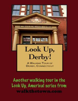
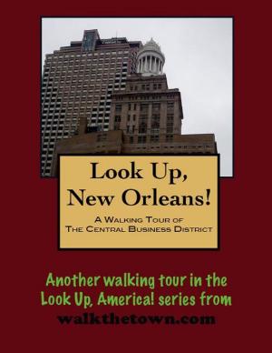
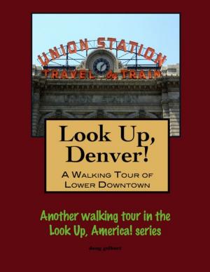
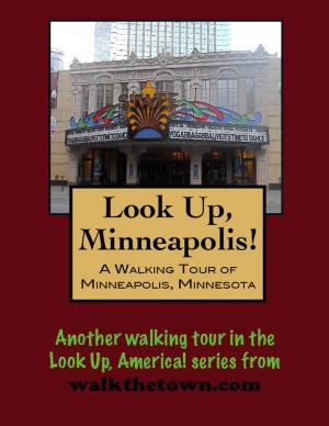
There is no better way to see America than on foot. And there is no better way to appreciate what you are looking at than with a walking tour. Whether you are preparing for a road trip or just out to look at your own town in a new way, a downloadable walking tour is ready to explore when you are.
Each walking tour describes historical and architectural landmarks and provides pictures to help out when those pesky street addresses are missing. Every tour also includes a quick primer on identifying architectural styles seen on American streets.
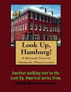
In 1733, the site of present day Reading was chosen. It was set at the intersection of two great valleys, the east Penn-Lebanon Valley and the Schuylkill river. This site was known as Finney’s Ford until 1743 when Thomas Lawrence, a Penn Land agent, made the first attempt at the layout for Reading.
In 1748, the town was laid out by Thomas and Richard Penn, the sons of William Penn. The name was chosen after Penn’s own county seat, Reading, in Berkshire, England. In 1752, Reading became the county seat of Berks county.
During the French and Indian war, Reading became a military base for a chain of forts along the Blue Mountains. The local iron industry, by the time of the Revolution had a total production that exceeded that of England, a production that would help supply Washington’s troops with weapons including cannons, rifles and ammunition. During the early period of the war, Reading was again a depot for military supply. Hessian prisoners from the battle of Trenton were also detained here.
The center of Reading was known as market square, with open sheds where farmers would sell their produce and hold a yearly fair. Later the square became the center of government and commerce with the County Courthouse, banks, stores and hotels located on the site. The construction of the Reading Railroad, its lines radiating in all directions from the City, was probably the greatest single factor in the development of Berks County. Established in 1833 to transport coal, its operations grew to include coal mining, iron making, canal and sea-going transportation and shipbuilding. By 1870 it was the largest corporation in the world.
Reading did not officially incorporate as a city until the 1840s, when its population had grown to 12,000 people living in rows of red brick houses. In the fifty years following the Civil War, Reading continued to grow as an industrial city, supporting one of the most diverse manufacturing bases of any city in the country. Bicycles, wagons, hats, cigars, clocks, shoes, brass, bricks, steam engines, rope, beer and pretzels, and many other items were all manufactured in the city or the surrounding area. In 1900 Charles Duryea came to Reading to make one of the earliest automobiles. Duryea Drive on Mt. Penn still carries his name and is the site of an annual car race up to the top of the mountain.
This walking tour will begin in City Park, or Penn’s Common, just east of city center...
There is no better way to see America than on foot. And there is no better way to appreciate what you are looking at than with a walking tour. Whether you are preparing for a road trip or just out to look at your own town in a new way, a downloadable walking tour is ready to explore when you are.
Each walking tour describes historical and architectural landmarks and provides pictures to help out when those pesky street addresses are missing. Every tour also includes a quick primer on identifying architectural styles seen on American streets.
In 1733, the site of present day Reading was chosen. It was set at the intersection of two great valleys, the east Penn-Lebanon Valley and the Schuylkill river. This site was known as Finney’s Ford until 1743 when Thomas Lawrence, a Penn Land agent, made the first attempt at the layout for Reading.
In 1748, the town was laid out by Thomas and Richard Penn, the sons of William Penn. The name was chosen after Penn’s own county seat, Reading, in Berkshire, England. In 1752, Reading became the county seat of Berks county.
During the French and Indian war, Reading became a military base for a chain of forts along the Blue Mountains. The local iron industry, by the time of the Revolution had a total production that exceeded that of England, a production that would help supply Washington’s troops with weapons including cannons, rifles and ammunition. During the early period of the war, Reading was again a depot for military supply. Hessian prisoners from the battle of Trenton were also detained here.
The center of Reading was known as market square, with open sheds where farmers would sell their produce and hold a yearly fair. Later the square became the center of government and commerce with the County Courthouse, banks, stores and hotels located on the site. The construction of the Reading Railroad, its lines radiating in all directions from the City, was probably the greatest single factor in the development of Berks County. Established in 1833 to transport coal, its operations grew to include coal mining, iron making, canal and sea-going transportation and shipbuilding. By 1870 it was the largest corporation in the world.
Reading did not officially incorporate as a city until the 1840s, when its population had grown to 12,000 people living in rows of red brick houses. In the fifty years following the Civil War, Reading continued to grow as an industrial city, supporting one of the most diverse manufacturing bases of any city in the country. Bicycles, wagons, hats, cigars, clocks, shoes, brass, bricks, steam engines, rope, beer and pretzels, and many other items were all manufactured in the city or the surrounding area. In 1900 Charles Duryea came to Reading to make one of the earliest automobiles. Duryea Drive on Mt. Penn still carries his name and is the site of an annual car race up to the top of the mountain.
This walking tour will begin in City Park, or Penn’s Common, just east of city center...