| Author: | Doug Gelbert | ISBN: | 9781458039439 |
| Publisher: | Doug Gelbert | Publication: | February 8, 2011 |
| Imprint: | Smashwords Edition | Language: | English |
| Author: | Doug Gelbert |
| ISBN: | 9781458039439 |
| Publisher: | Doug Gelbert |
| Publication: | February 8, 2011 |
| Imprint: | Smashwords Edition |
| Language: | English |
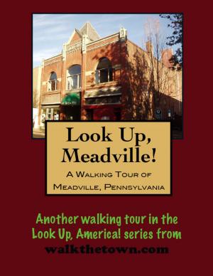
There is no better way to see America than on foot. And there is no better way to appreciate what you are looking at than with a walking tour. Whether you are preparing for a road trip or just out to look at your own town in a new way, a downloadable walking tour is ready to explore when you are.
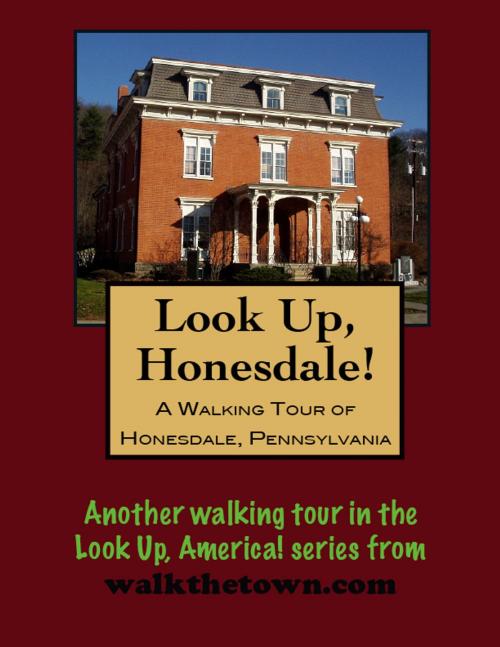
Each walking tour describes historical and architectural landmarks and provides pictures to help out when those pesky street addresses are missing. Every tour also includes a quick primer on identifying architectural styles seen on American streets.
Only in the latter half of the eighteenth century did settlers from Connecticut get around to clearing the land in the wooded northern hills of Wayne County. Dyberry Forks, which was to become the county seat, was then just a swampy wilderness at the point where the Dyberry River joins the Lackawaxen on its way to the Delaware.
The town got started in the 1820s because of Maurice and William Wurts’s coal business. To get their anthracite coal from the mines in Carbondale to seaboard cities, they decided to build a canal from Dyberry Forks to Rondout (now Kingston), New York, on the Hudson River. That was only the second of their two problems - the coal wasn’t in Dyberry Forks - it was in Carbondale across 1,942-foot-high Farview Mountain. In 1825, backed by Philip Hone, a successful businessman turned mayor of New York, the Wurtses succeeded in raising over $1 million for their Delaware and Hudson Canal Company, and they were off.
By October 1828, Philip Hone, inspecting the newly completed D&H Canal, marveled at the ‘’stupendous stone work’’ and the impressive rock cuts - entirely achieved by men, mostly ‘’wild Irish’’ immigrants, wielding pick and shovel and the unpredictable black blasting powder of the day. The canal negotiated a drop of 1,030 feet by means of a series of more than 100 locks, in the 108-mile journey to Kingston.
Honesdale was incorporated in 1831. Its sole purpose was to serve as the jumping off point for canal barges loaded with coal headed for New York City markets. That coal came over the mountain from Carbondale on a ‘’gravity railroad’’ as loaded cars were hauled up on tracks on a series of planes, or inclines, to the top of Farview by stationary steam engines, then lowered by gravity down planes on the other side to the town of Waymart, finally coasting on a steady downgrade into Honesdale. Empty cars were brought back to Waymart by horse or mule. At one time Honesdale had the largest stockpile of coal in the world.
By the mid-19th century Honesdale was a bustling waterfront town; it became the county seat in 1841. Our walking tour will begin in the parking lot in the center of town in front of the Visitor Center, that was actually a boat basin once at the start of the historical canal...
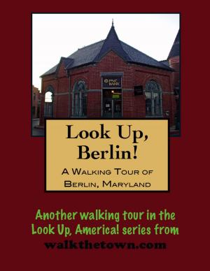
There is no better way to see America than on foot. And there is no better way to appreciate what you are looking at than with a walking tour. Whether you are preparing for a road trip or just out to look at your own town in a new way, a downloadable walking tour is ready to explore when you are.
Each walking tour describes historical and architectural landmarks and provides pictures to help out when those pesky street addresses are missing. Every tour also includes a quick primer on identifying architectural styles seen on American streets.
Only in the latter half of the eighteenth century did settlers from Connecticut get around to clearing the land in the wooded northern hills of Wayne County. Dyberry Forks, which was to become the county seat, was then just a swampy wilderness at the point where the Dyberry River joins the Lackawaxen on its way to the Delaware.
The town got started in the 1820s because of Maurice and William Wurts’s coal business. To get their anthracite coal from the mines in Carbondale to seaboard cities, they decided to build a canal from Dyberry Forks to Rondout (now Kingston), New York, on the Hudson River. That was only the second of their two problems - the coal wasn’t in Dyberry Forks - it was in Carbondale across 1,942-foot-high Farview Mountain. In 1825, backed by Philip Hone, a successful businessman turned mayor of New York, the Wurtses succeeded in raising over $1 million for their Delaware and Hudson Canal Company, and they were off.
By October 1828, Philip Hone, inspecting the newly completed D&H Canal, marveled at the ‘’stupendous stone work’’ and the impressive rock cuts - entirely achieved by men, mostly ‘’wild Irish’’ immigrants, wielding pick and shovel and the unpredictable black blasting powder of the day. The canal negotiated a drop of 1,030 feet by means of a series of more than 100 locks, in the 108-mile journey to Kingston.
Honesdale was incorporated in 1831. Its sole purpose was to serve as the jumping off point for canal barges loaded with coal headed for New York City markets. That coal came over the mountain from Carbondale on a ‘’gravity railroad’’ as loaded cars were hauled up on tracks on a series of planes, or inclines, to the top of Farview by stationary steam engines, then lowered by gravity down planes on the other side to the town of Waymart, finally coasting on a steady downgrade into Honesdale. Empty cars were brought back to Waymart by horse or mule. At one time Honesdale had the largest stockpile of coal in the world.
By the mid-19th century Honesdale was a bustling waterfront town; it became the county seat in 1841. Our walking tour will begin in the parking lot in the center of town in front of the Visitor Center, that was actually a boat basin once at the start of the historical canal...