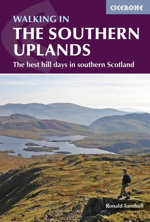
Walking in the Southern Uplands
44 best hill days in southern Scotland
Nonfiction, Travel, Europe, Great Britain, Sports, Outdoors, Hiking| Author: | Ronald Turnbull | ISBN: | 9781783621293 |
| Publisher: | Cicerone Press | Publication: | November 25, 2014 |
| Imprint: | Cicerone Press | Language: | English |
| Author: | Ronald Turnbull |
| ISBN: | 9781783621293 |
| Publisher: | Cicerone Press |
| Publication: | November 25, 2014 |
| Imprint: | Cicerone Press |
| Language: | English |
This guidebook describes 44 routes and over 100 summits across the Southern Uplands of Scotland, stretching south-west from Edinburgh to the English border, including the Galloway and Pentland Hills. The walks range between 2 and 29km, suitable for walkers of all abilities. The Scottish Southern Uplands is a range that is about as big as the English Pennines. It is wild hill country, with over 80 hills of 2000ft or more, and it boasts a real remoteness that is difficult to find elsewhere. All hillwalkers should experience these wonderfully characterful landscapes: green and gentle, but with hidden surprises and remote escapes. The routes are suitable from spring to autumn, and on winter days with good weather and snow conditions. Each route provides OS mapping, information on distance, ascent, time, maximum altitude and terrain, as well as details of any variants or shortcuts. With notes on points of interest along the way as well as on transport and accommodation, the guide gives all the information walkers need.
This guidebook describes 44 routes and over 100 summits across the Southern Uplands of Scotland, stretching south-west from Edinburgh to the English border, including the Galloway and Pentland Hills. The walks range between 2 and 29km, suitable for walkers of all abilities. The Scottish Southern Uplands is a range that is about as big as the English Pennines. It is wild hill country, with over 80 hills of 2000ft or more, and it boasts a real remoteness that is difficult to find elsewhere. All hillwalkers should experience these wonderfully characterful landscapes: green and gentle, but with hidden surprises and remote escapes. The routes are suitable from spring to autumn, and on winter days with good weather and snow conditions. Each route provides OS mapping, information on distance, ascent, time, maximum altitude and terrain, as well as details of any variants or shortcuts. With notes on points of interest along the way as well as on transport and accommodation, the guide gives all the information walkers need.
