Esri Press: 52 books

by
Language: English
Release Date: January 6, 2014
Language: English
Release Date: January 6, 2014
The GIS Guide for Elected Officials is a valuable resource for government officials who want to better understand how to use geographic information systems (GIS) to answer location-based questions such as the following:
-Can work crews respond more efficiently to service calls?
-Where...

by J. Allison Butler
Language: English
Release Date: August 28, 2015
Language: English
Release Date: August 28, 2015
Designing Geodatabases for Transportation addresses the construction of a GIS to manage data describing the transportation facilities and services commonly organized around various modes of travel. Although details of each mode can be quite different, this book demonstrates how all modes of travel...

Lining Up Data in ArcGIS
A Guide to Map Projections
Language: English
Release Date: February 18, 2013
Lining Up Data in ArcGIS: A Guide to Map Projections is an easy-to-navigate troubleshooting reference for any GIS user with the common problem of data misalignment. Complete with full-color maps and diagrams, this book presents practical techniques on how to identify data projections, create custom...
GEOdiseño
Métodos de Planificación Integral del Territorio
Language: English
Release Date: May 12, 2014
GEOdiseño. Métodos de Planificación Integral del Territorio, trata del proyecto en general y del geodiseño en particular. El geodiseño, como idea, posibilita una colaboración más efectiva y simbiótica entre las profesiones de las ciencias del territorio y aquellas cuyo fin es proyectar y planificar,...
Designing Better Maps
A Guide for GIS Users
Language: English
Release Date: March 28, 2016
Designing Better Maps: A Guide for GIS Users, second edition, is a comprehensive guide to creating maps that communicate effectively. In Designing Better Maps, renowned cartographer Cynthia A. Brewer guides readers through the basics of good cartography, including layout design, scales, projections,...

Cartographies of Disease
Maps, Mapping, and Medicine, new expanded edition
Language: English
Release Date: January 23, 2017
Cartographies of Disease: Maps, Mapping, and Medicine, new expanded edition, is a comprehensive survey of the technology of mapping and its relationship to the battle against disease. This look at medical mapping advances the argument that maps are not merely representations of spatial realities but...

GIS Tutorial for Health
Fifth Edition
Language: English
Release Date: December 3, 2014
A handbook for teaching GIS to healthcare professionals, this reference discusses learning GIS software in the context of visualizing and analyzing health-related data. By outlining a hands-on approach that simulates how a GIS project would be developed in the real world, the included exercises set...

Tribal GIS
Supporting Native American Decision-Making
Language: English
Release Date: July 14, 2017
Supporting tribes with an all new chapter on ArcGIS Pro, written by tribal leaders who successfully use GIS.
In Tribal GIS: Supporting Native American Decision-Making, tribal leaders tell their stories about implementing and using geographic information systems (GIS) to address their unique...
Citizen Planners
Shaping Communities with Spatial Tools
Language: English
Release Date: January 1, 2015
Citizen Planners: Shaping Communities with Spatial Tools describes how geographic information systems can be made accessible to ordinary citizens with little or no professional training to help plan and shape their local communities. The book focuses on the efforts of a group of Wisconsin citizens...
by C. Dana Tomlin
Language: English
Release Date: September 10, 2012
Language: English
Release Date: September 10, 2012
GIS and Cartographic Modeling is a foundational work in the field of geographic information systems (GIS). An introduction to the concepts, conventions, and capabilities of map algebra as a general language, this book describes the analytical use of raster-based GIS. By focusing on the fundamentals of...

Analyzing Urban Poverty
GIS for the Developing World
Language: English
Release Date: January 1, 2015
In developing countries, squatter developments that house more than one-third of the urban population are without infrastructure and built from materials at hand. Analyzing Urban Poverty: GIS in the Developing World demonstrates how geographic information systems (GIS) can be used to improve quality...

Abstract Machine
Humanities GIS
Language: English
Release Date: August 19, 2015
In Abstract Machine, author Charles Travis uses GIS technology to interpret, analyze, and visualize literary, historical, and philosophical texts. Travis's study shows how mapping language patterns, fictional landscapes, geographic spaces, and philosophical concepts helps support critical analysis....

by Joseph J. Kerski, Jill Clark
Language: English
Release Date: June 29, 2012
Language: English
Release Date: June 29, 2012
The GIS Guide to Public Domain Data gives users of geographic information systems (GIS) relevant information about the sources and quality of available public domain spatial data. Readers will understand how to find, evaluate, and analyze data to solve location-based problems. This guide covers practical...
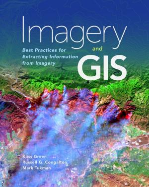
Imagery and GIS
Best Practices for Extracting Information from Imagery
Language: English
Release Date: October 25, 2017
Imagery and GIS, working together, expand our perspective so that we can better perceive and understand The Science of Where™.
Today, most maps include imagery in the form of aerial photos, satellite images, thermal images, digital elevation models, and scanned maps. Imagery and GIS: Best Practices...