Remote Sensing category: 317 books
Spatial Data Mining
Theory and Application
Language: English
Release Date: March 23, 2016
· This book is an updated version of a well-received book previously published in Chinese by Science Press of China (the first edition in 2006 and the second in 2013). It offers a systematic and practical overview of spatial data mining, which combines computer science and geo-spatial...
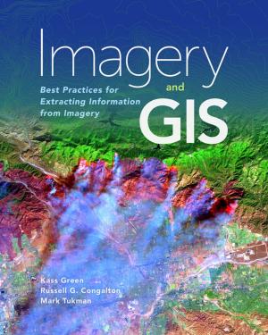
Imagery and GIS
Best Practices for Extracting Information from Imagery
Language: English
Release Date: October 25, 2017
Imagery and GIS, working together, expand our perspective so that we can better perceive and understand The Science of Where™.
Today, most maps include imagery in the form of aerial photos, satellite images, thermal images, digital elevation models, and scanned maps. Imagery and GIS: Best Practices...
Earth Science Satellite Applications
Current and Future Prospects
Language: English
Release Date: May 21, 2016
The combined observational power of the multiple earth observing satellites is currently not being harnessed holistically to produce more durable societal benefits. We are not able to take complete advantage of the prolific amount of scientific output and remote sensing data that are emerging rapidly...
Environmental Information Systems
Concepts, Methodologies, Tools, and Applications
Language: English
Release Date: September 7, 2018
Environmental information and systems play a major role in environmental decision making. As such, it is vital to understand the impact that they have on different aspects of sustainable environmental management, as well as to understand the opportunism they might present for further improvement....
Geospatial Technologies in Urban System Development
Emerging Research and Opportunities
Language: English
Release Date: December 15, 2017
Technological advancements have changed the way we think of traditional urban and spatial planning. The inclusion of conventional elements with modern technologies is allowing this field to advance at a rapid pace. Geospatial Technologies in Urban System Development: Emerging Research and Opportunities...
Global LAnd Surface Satellite (GLASS) Products
Algorithms, Validation and Analysis
Language: English
Release Date: November 5, 2013
This book describes the algorithms, validation and preliminary analysis of the Global LAnd Surface Satellite (GLASS) products, a long-term, high-quality dataset that is now freely available worldwide to government organizations and agencies, scientific research institutions, students and members of...
by Chris B. Jones
Language: English
Release Date: May 1, 2014
Language: English
Release Date: May 1, 2014
A concise text presenting the fundamental concepts in Geographical Information Systems (GIS), emphasising an understanding of techniques in management, analysis and graphic display of spatial information.
Divided into five parts - the first part reviews the development and application of GIS,...
Dynamic land use/cover change modelling
Geosimulation and multiagent-based modelling
Language: English
Release Date: October 1, 2011
The thesis is an original and novel contribution to land use/land cover change analysis using methods of geosimulation and agent-based modeling. The author implements several traditional methodologies of land use change by means of remote sensing and GIS techniques. An Agent-Based Model was developed...
by
Language: English
Release Date: September 4, 2012
Language: English
Release Date: September 4, 2012
This book examines the application of geotechniques to address a wide range of issues facing urban water resources. Growing populations leading to urbanization and related development have lead to problems associated with water quality, storm water management, flood control, environmental health,...
by Qin Zhang, Roger Skjetne
Language: English
Release Date: February 13, 2018
Language: English
Release Date: February 13, 2018
Sea Ice Image Processing with MATLAB addresses the topic of image processing for the extraction of key sea ice characteristics from digital photography, which is of great relevance for Artic remote sensing and marine operations. This valuable guide provides tools for quantifying the ice environment...
by
Language: English
Release Date: January 5, 2015
Language: English
Release Date: January 5, 2015
The current volume provides examples of how environmental hazards such as landslides, earthquakes, mountain processes, cold climate processes and tidal flows and currents can affect the energy supply infrastructure. In times of uncertainty, the security of the European cross-border energy supply infrastructure,...
by
Language: English
Release Date: December 6, 2012
Language: English
Release Date: December 6, 2012
Remote sensing is the study of a region from a distance, particularly from an airplane or a spacecraft. It is a tool that can be used in conjunction with other methods of research and investigation. This tool is especially applicable to the study of the deserts and arid lands of the Earth because...
Digital Airborne Camera
Introduction and Technology
Language: English
Release Date: December 10, 2009
Digital airborne cameras are now penetrating the fields of photogrammetry and remote sensing. Due to the last decade’s results in research and development in the fields of for instance detector technology, computing power, memory capacity position and orientation measurement it is now possible to...
by
Language: English
Release Date: December 19, 2017
Language: English
Release Date: December 19, 2017
Through-the-wall radar imaging (TWRI) allows police, fire and rescue personnel, first responders, and defense forces to detect, identify, classify, and track the whereabouts of humans and moving objects. Electromagnetic waves are considered the most effective at achieving this objective, yet advances...


