Remote Sensing category: 317 books
by Wilpen L. Gorr, Kristen S. Kurland, Zan M. Dodson
Language: English
Release Date: April 25, 2018
Language: English
Release Date: April 25, 2018
GIS Tutorial for Crime Analysis, second edition, is a workbook for crime analysts and students of criminology. The book presents state-of-the-art methods that can be incorporated into any police department’s standard practices. This second edition builds upon the first edition by updating tutorials,...
by
Language: English
Release Date: June 26, 2018
Language: English
Release Date: June 26, 2018
This book elucidates how cyberGIS (that is, new-generation geographic information science and systems (GIS) based on advanced computing and cyberinfrastructure) transforms computation- and data-intensive geospatial discovery and innovation. It comprehensively addresses opportunities and challenges,...
Getting to Know Web GIS
Third Edition
Language: English
Release Date: May 14, 2018
Getting to Know Web GIS, third edition, pairs fundamental principles with step-by-step exercises to teach readers how to share resources online and build Web GIS apps easily and quickly. Start now building Web apps without a single line of programming, and then move on to developing more advanced...
Understanding GIS
An ArcGIS Pro Project Workbook
Language: English
Release Date: July 6, 2018
The first single-project GIS textbook on the market, Understanding GIS: An ArcGIS Pro Project Workbook, fourth edition is an excellent resource for students and educators seeking a guide for an advanced, single-project-based course that incorporates GIS across a wide range of disciplines. It allows...
by Sergio Martin
Language: Spanish
Release Date: September 5, 2017
Language: Spanish
Release Date: September 5, 2017
Se el atribuye a Platón el decir que si una disciplina no puede medir o pesar de alguna forma las magnitudes que le interesan, queda muy poco de esa disciplina. El hecho es que en el campo científico siempre ha habido necesidad de desarrollar técnicas de medición de alguna especie, y ello ha llevado...
GIS Research Methods
Incorporating Spatial Perspectives
Language: English
Release Date: May 1, 2015
GIS Research Methods: Incorporating Spatial Perspectives shows researchers how to incorporate spatial thinking and geographic information system (GIS) technology into research design and analysis. Topics include research design, digital data sources, volunteered geographic information, analysis using...
Urban Air Pollution Monitoring by Ground-Based Stations and Satellite Data
Multi-season characteristics from Lanzhou City, China
Language: English
Release Date: May 11, 2018
This book examines air pollution of a big city using multi-year and multi-season data from ground-based air monitoring stations and satellite sounding data, which provides more clear and detailed information on the main sources of air pollution, the long-term trend of pollution, the influence of meteorological...
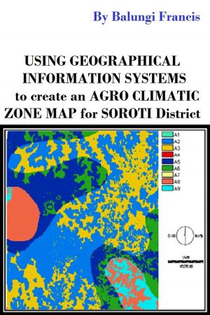
Using Geographical Information Systems to Create an Agroclimatic Zone map for Soroti District
Pursuing a Nobel Prize
Language: English
Release Date: May 17, 2019
Balungi Francis has done research in agro-climatic zoning with emphasis on its application to agriculture. The research can assist both agriculturalists and policy makers by showing areas that are climatologically suitable for particular crops and to guide the work of planners and farmers. It can...
by Ewa Krzywicka-Blum
Language: English
Release Date: November 22, 2016
Language: English
Release Date: November 22, 2016
This book departs from typical cartography textbooks, which tend to focus on the characteristics of the methods and means of expression. Instead, it offers an explanation of the individual perspective on the map as a specific product of civilization, one that constitutes a component of social communication.
The...
Quo Vadis: Evolution of Modern Navigation
The Rise of Quantum Techniques
Language: English
Release Date: October 16, 2013
Quo Vadis: Evolution of Modern Navigation presents an intelligent and intelligible account of the essential principles underlying the design of satellite navigational systems—with introductory chapters placing them in context with the early development of navigational methods. The material is organized...
Spatial Context
An Introduction to Fundamental Computer Algorithms for Spatial Analysis
Language: English
Release Date: April 17, 2018
Many disciplines are concerned with manipulating geometric (or spatial) objects in the computer – such as geology, cartography, computer aided design (CAD), etc. – and each of these have developed their own data structures and techniques, often independently. Nevertheless, in many cases the object types and the spatial queries are similar, and this book attempts to find a common theme.
Real time deforestation detection using ANN and Satellite images
The Amazon Rainforest study case
Language: English
Release Date: April 25, 2015
The foremost aim of the present study was the development of a tool to detect daily deforestation in the Amazon rainforest, using satellite images from the MODIS/TERRA sensor and Artificial Neural Networks. The developed tool provides parameterization of the configuration for the neural network training...
by
Language: English
Release Date: December 19, 2018
Language: English
Release Date: December 19, 2018
Central Asia is a large and understudied region of varied geography, ranging from the high passes and mountains of Tian Shan, to the vast deserts of Kyzyl Kum, Taklamakan to the grassy treeles steppes.
This region is faced with adverse conditions, as much of the land is too dry or rugged for...
by
Language: English
Release Date: January 5, 2018
Language: English
Release Date: January 5, 2018
The limitations of satellites create a large gap in assistive directional technologies, especially indoors. The methods and advances in alternate directional technologies is allowing for new systems to fill the gaps caused by the limitations of GPS systems. Positioning and Navigation in Complex Environments...


