| Author: | Doug Gelbert | ISBN: | 9781458080035 |
| Publisher: | Doug Gelbert | Publication: | January 29, 2011 |
| Imprint: | Smashwords Edition | Language: | English |
| Author: | Doug Gelbert |
| ISBN: | 9781458080035 |
| Publisher: | Doug Gelbert |
| Publication: | January 29, 2011 |
| Imprint: | Smashwords Edition |
| Language: | English |
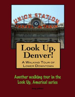
There is no better way to see America than on foot. And there is no better way to appreciate what you are looking at than with a walking tour. Whether you are preparing for a road trip or just out to look at your own town in a new way, a downloadable walking tour is ready to explore when you are.
Each walking tour describes historical and architectural landmarks and provides pictures to help out when those pesky street addresses are missing. Every tour also includes a quick primer on identifying architectural styles seen on American streets.
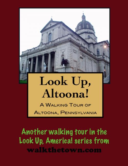
Before the Pennsylvania Railroad (PRR) stretched between Philadelphia and Pittsburgh, a system of railroads, canals and inclined planes across the Alleghenies, known as the Main Line of Public Works, linked the eastern and western sections of the state. The system was time consuming and inefficient, if not entirely useless during the winter freeze and spring floods. Meanwhile, Pennsylvania was rapidly being usurped by New York state and its Erie Canal as America’s pathway to the West.
The State Canal Commission looked to compete with a cross-state train route for which their engineer, Charles L. Schlatter, identified three possible routes. Understandably, when the founders of the PRR approached the State legislature in 1846 to build the railroad, the latter passed an act incorporating the Pennsylvania Railroad Company and granted its charter. John Edgar Thomson, Chief Engineer of the new company, then selected Schlatter’s central or Juniata-Conemaugh River route. Because Thomson’s scheme maximized use of the low grades over the majority of the route west with a short, but steep climb over the mountains, he needed additional engine power to be available at a convenient location. The point at which the water grade ended and the mountain passage began was Robinson’s Ridge, the present site of Altoona, located 117 miles east of Pittsburgh and 235 miles west of Philadelphia. Here, beginning in 1849, the PRR built a facility for housing and repairing the additional motive power — it also spurred the development of a city.
West of town the challenge of carrying the Pennsylvania Railroad Mainline over the rugged Allegheny Mountains was met with the design and construction of “The Horseshoe Curve” in 1854. The huge lop connects one side of the valley with the other and was carved from the rugged mountainside entirely by men using picks, shovels and horses. To this day, the curve is considered to be an engineering marvel. Spending so much time digging out the curve it was natural that Altoona would become the major supplying town to the railroad industry, and for several years Altoona was the greatest railroad town in America.
Altoona was incorporated as a borough on February 6, 1854, and as a city under legislation approved on April 3, 1867, and February 8, 1868. The town grew rapidly in the late 19th century, its population approximately 2,000 in 1854, 10,000 in 1870, and 20,000 in 1880. In the early 20th century, the Pennsylvania Railroad’s Alttona Works complex alone employed, at its peak, approximately 15,000 people and covered three miles in length, 218 acres of yards and 37 acres of indoor workshop floor space in 122 buildings.
Live by the railroad, die by the railroad; Altoona declined in tandem with the abandonment of rail passenger service in America after World War II. Our walking tour will concentrate on the downtown area and visit financial sites, cultural sites, residential sites, sacred sites and, of course, the remnants of the largest railroad shops America has ever seen...
There is no better way to see America than on foot. And there is no better way to appreciate what you are looking at than with a walking tour. Whether you are preparing for a road trip or just out to look at your own town in a new way, a downloadable walking tour is ready to explore when you are.
Each walking tour describes historical and architectural landmarks and provides pictures to help out when those pesky street addresses are missing. Every tour also includes a quick primer on identifying architectural styles seen on American streets.
Before the Pennsylvania Railroad (PRR) stretched between Philadelphia and Pittsburgh, a system of railroads, canals and inclined planes across the Alleghenies, known as the Main Line of Public Works, linked the eastern and western sections of the state. The system was time consuming and inefficient, if not entirely useless during the winter freeze and spring floods. Meanwhile, Pennsylvania was rapidly being usurped by New York state and its Erie Canal as America’s pathway to the West.
The State Canal Commission looked to compete with a cross-state train route for which their engineer, Charles L. Schlatter, identified three possible routes. Understandably, when the founders of the PRR approached the State legislature in 1846 to build the railroad, the latter passed an act incorporating the Pennsylvania Railroad Company and granted its charter. John Edgar Thomson, Chief Engineer of the new company, then selected Schlatter’s central or Juniata-Conemaugh River route. Because Thomson’s scheme maximized use of the low grades over the majority of the route west with a short, but steep climb over the mountains, he needed additional engine power to be available at a convenient location. The point at which the water grade ended and the mountain passage began was Robinson’s Ridge, the present site of Altoona, located 117 miles east of Pittsburgh and 235 miles west of Philadelphia. Here, beginning in 1849, the PRR built a facility for housing and repairing the additional motive power — it also spurred the development of a city.
West of town the challenge of carrying the Pennsylvania Railroad Mainline over the rugged Allegheny Mountains was met with the design and construction of “The Horseshoe Curve” in 1854. The huge lop connects one side of the valley with the other and was carved from the rugged mountainside entirely by men using picks, shovels and horses. To this day, the curve is considered to be an engineering marvel. Spending so much time digging out the curve it was natural that Altoona would become the major supplying town to the railroad industry, and for several years Altoona was the greatest railroad town in America.
Altoona was incorporated as a borough on February 6, 1854, and as a city under legislation approved on April 3, 1867, and February 8, 1868. The town grew rapidly in the late 19th century, its population approximately 2,000 in 1854, 10,000 in 1870, and 20,000 in 1880. In the early 20th century, the Pennsylvania Railroad’s Alttona Works complex alone employed, at its peak, approximately 15,000 people and covered three miles in length, 218 acres of yards and 37 acres of indoor workshop floor space in 122 buildings.
Live by the railroad, die by the railroad; Altoona declined in tandem with the abandonment of rail passenger service in America after World War II. Our walking tour will concentrate on the downtown area and visit financial sites, cultural sites, residential sites, sacred sites and, of course, the remnants of the largest railroad shops America has ever seen...